Emery County · stream · order 4 river · ~48 cfs typical
Left Fork Huntington Creek
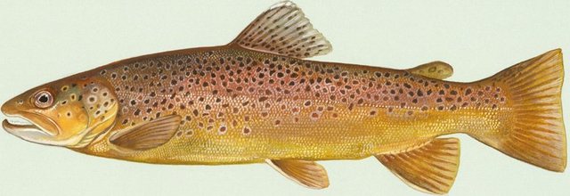
Left Fork Huntington Creek is a stream in Emery County, Utah, stocked with Brown Trout and Cutthroat Trout (Colorado River). FishableWaters aggregates every stocking record for this water from Utah's fish & wildlife agency; the latest schedule and today's bite windows are above.
Best days this week
Days near a new or full moon tend to fish best.
Today's bite windows
Conditions, next 3 days
Today
Clear
87°
63°
11 mph
2%
Sat
Overcast
90°
66°
13 mph
0%
Sun
Overcast
88°
66°
18 mph
0%
→ pressure steadyStable weather — expect a normal bite.
Stocking ledger
No published stocking records yet. This water stays in our books — the ledger begins the hour its state agency publishes a record.
Angler reports
What's biting
No reports yet — be the first
Best bite times
No reports yet
Field notes
No notes yet
All Utah waters with brown trout → · All Utah waters with cutthroat trout (colorado river) →
Nearby waters
- Miller Flat Creek4.8 mi
- Miller Flat Reservoir5.4 mistocked Jul 20, 2026
- Little Madsen Reservoir6.4 mi
- Cleveland Reservoir6.9 mistocked May 4, 2026
- Rolfson Reservoir6.8 mi
- Potters Ponds6.7 mistocked Jun 29, 2026
- Electric Lake8.8 mistocked Jul 20, 2026
- Huntington Reservoir8.5 mistocked Jul 20, 2026
Seasons, limits, and rules are the state's call — check the official UT regulations and buy your license before you go. We link the source; we never restate the rules.
Left Fork Huntington Creek fishing — FAQ
What fish are stocked in Left Fork Huntington Creek?+
Left Fork Huntington Creek is stocked with Brown Trout and Cutthroat Trout (Colorado River) in Emery County, Utah. The full stocking ledger is on this page.
Do I need a license to fish Left Fork Huntington Creek?+
Yes — Utah requires a fishing license. Buy one from the state and check current seasons and limits before you go; both are linked on this page.
Where is Left Fork Huntington Creek?+
Left Fork Huntington Creek is a stream in Emery County, Utah. Driving directions and an interactive topo map are on this page.